04 · Analytics · Term 5
Ang Mo Kio: Parcel to Unit
a place to come home to
GIS and BIM analysis of Ang Mo Kio, subzone to unit
A two-part analysis of Ang Mo Kio: QGIS mapping of land use and accessibility across the planning area, then a Revit model of a single DBSS block.
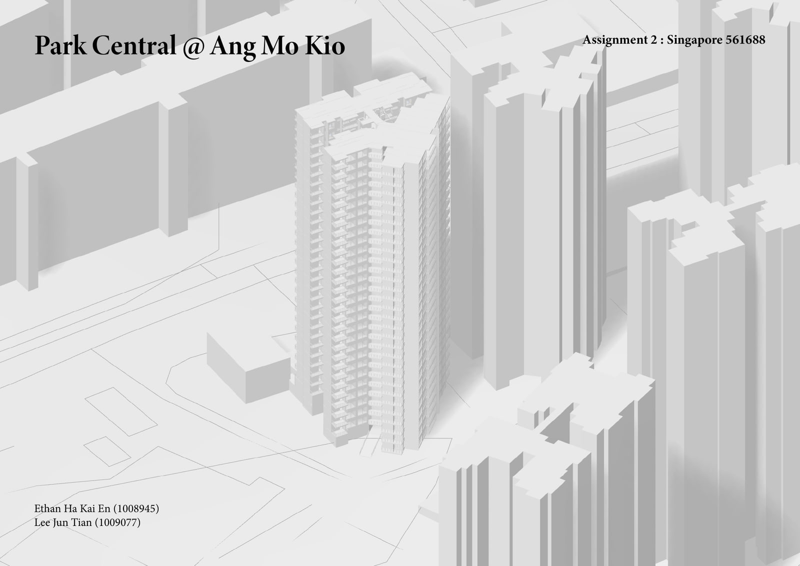
The course set two assignments on the same ground at two scales. The first reads the Ang Mo Kio planning area as an open-data problem, using QGIS to describe how land is allocated and how far residents have to walk. The second descends to a single address, Block 588A of Park Central @ Ang Mo Kio, and rebuilds it as a BIM model to measure the floor plate from the inside.
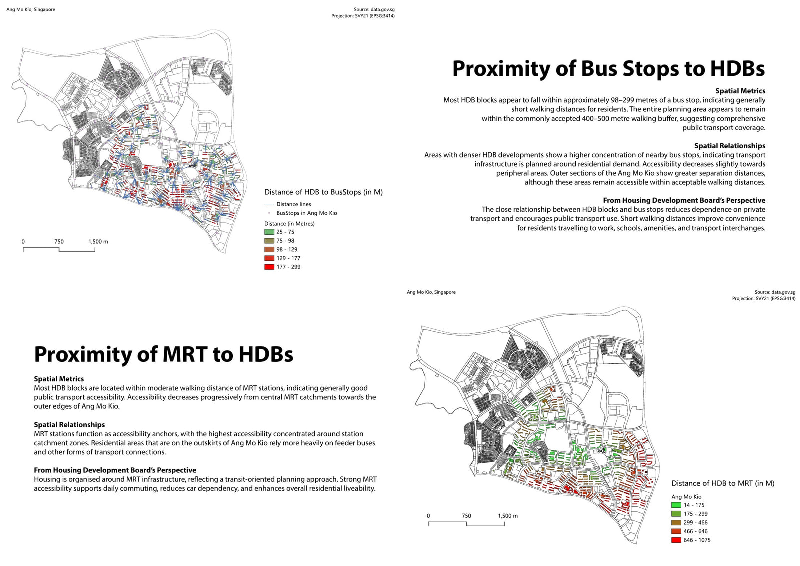
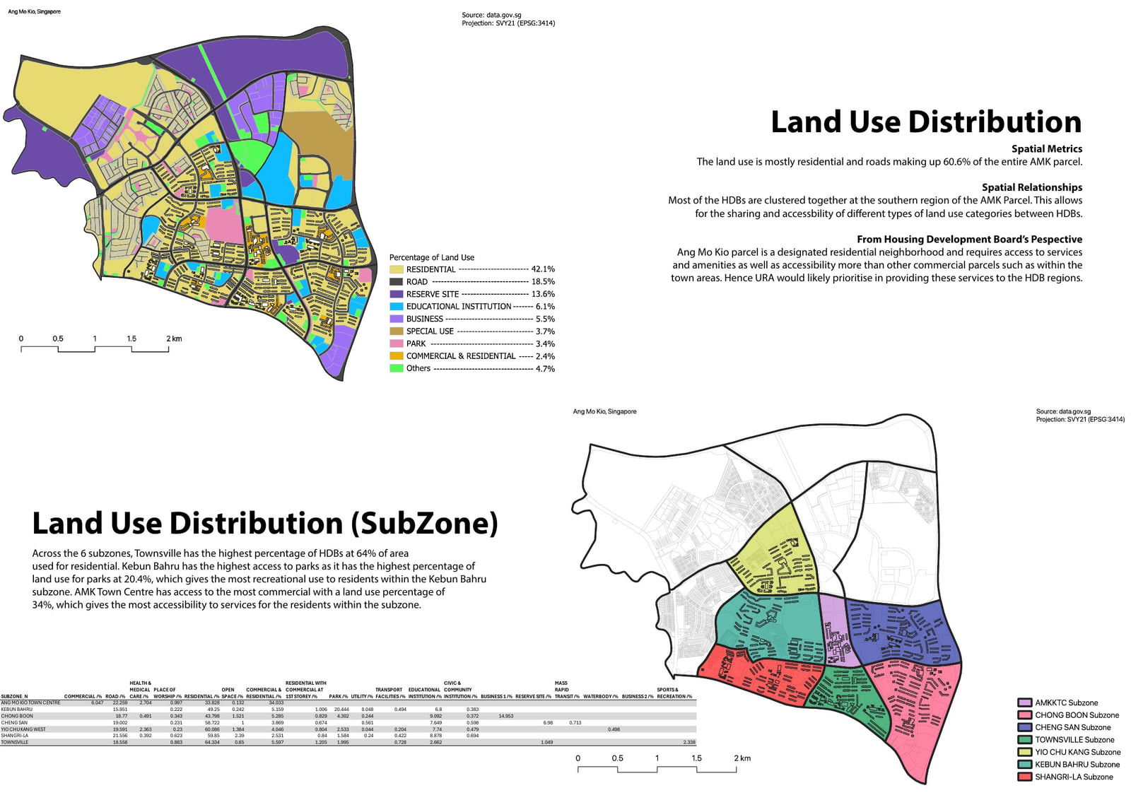
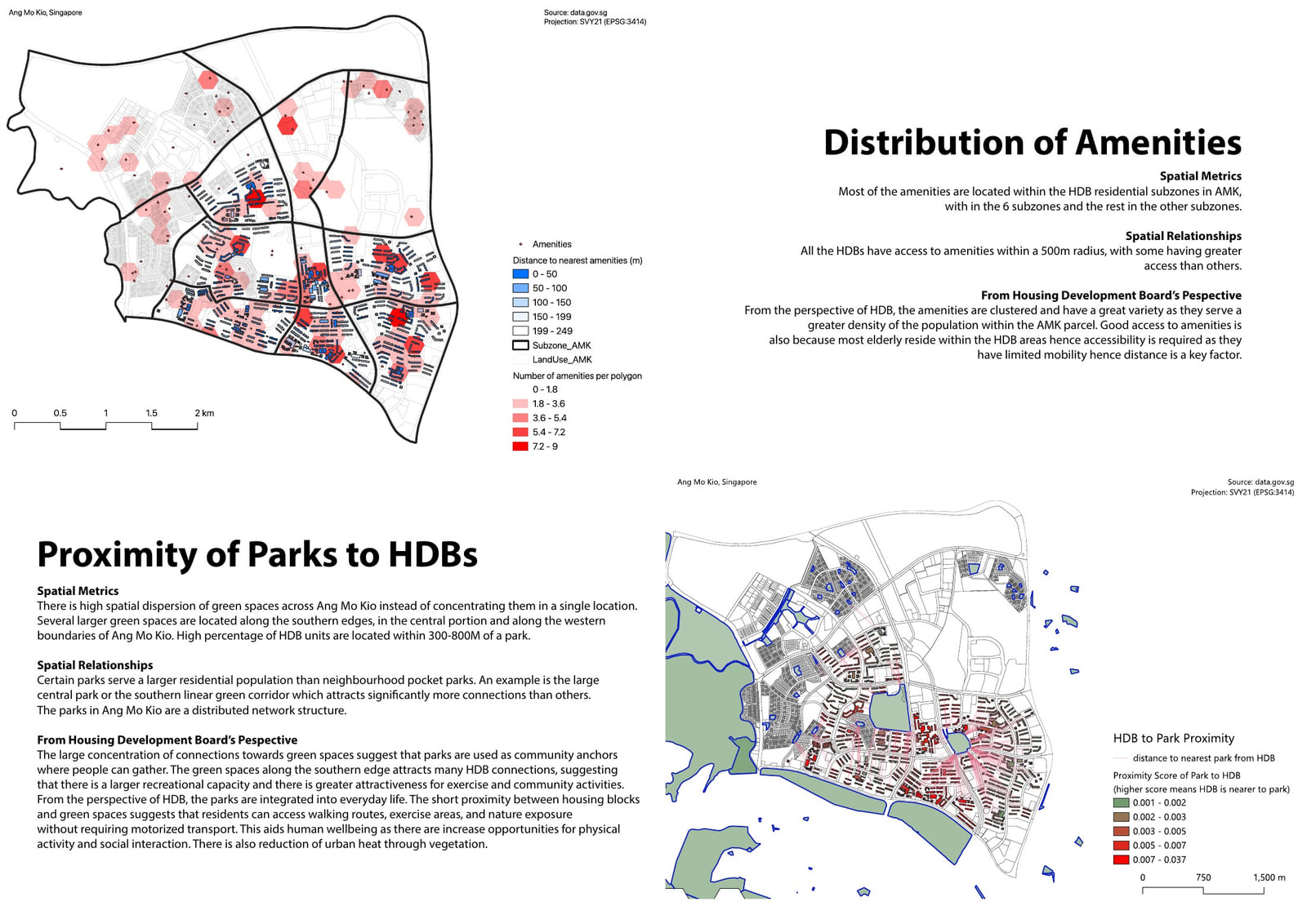
At parcel scale the work draws on data.gov.sg layers reprojected to SVY21 (EPSG:3414). Land use polygons are tabulated by area across nineteen categories and cross-cut by the seven subzones, producing a table that sets Townsville's 64% residential share against Kebun Bahru's 20.4% of land in parks and the Town Centre's 34% commercial. Residential land and roads together account for 60.6% of the parcel. Accessibility is handled by nearest-neighbour joins from every HDB block to the nearest amenity, park, bus stop and MRT station, drawn as distance lines and graduated by band: most blocks sit 98 to 299 metres from a bus stop, comfortably inside the conventional 400 to 500 metre walking buffer, while MRT accessibility falls off from the central catchments towards the edges of the planning area. A separate count of amenities per buffer polygon shows the clustering of services inside the denser southern subzones.
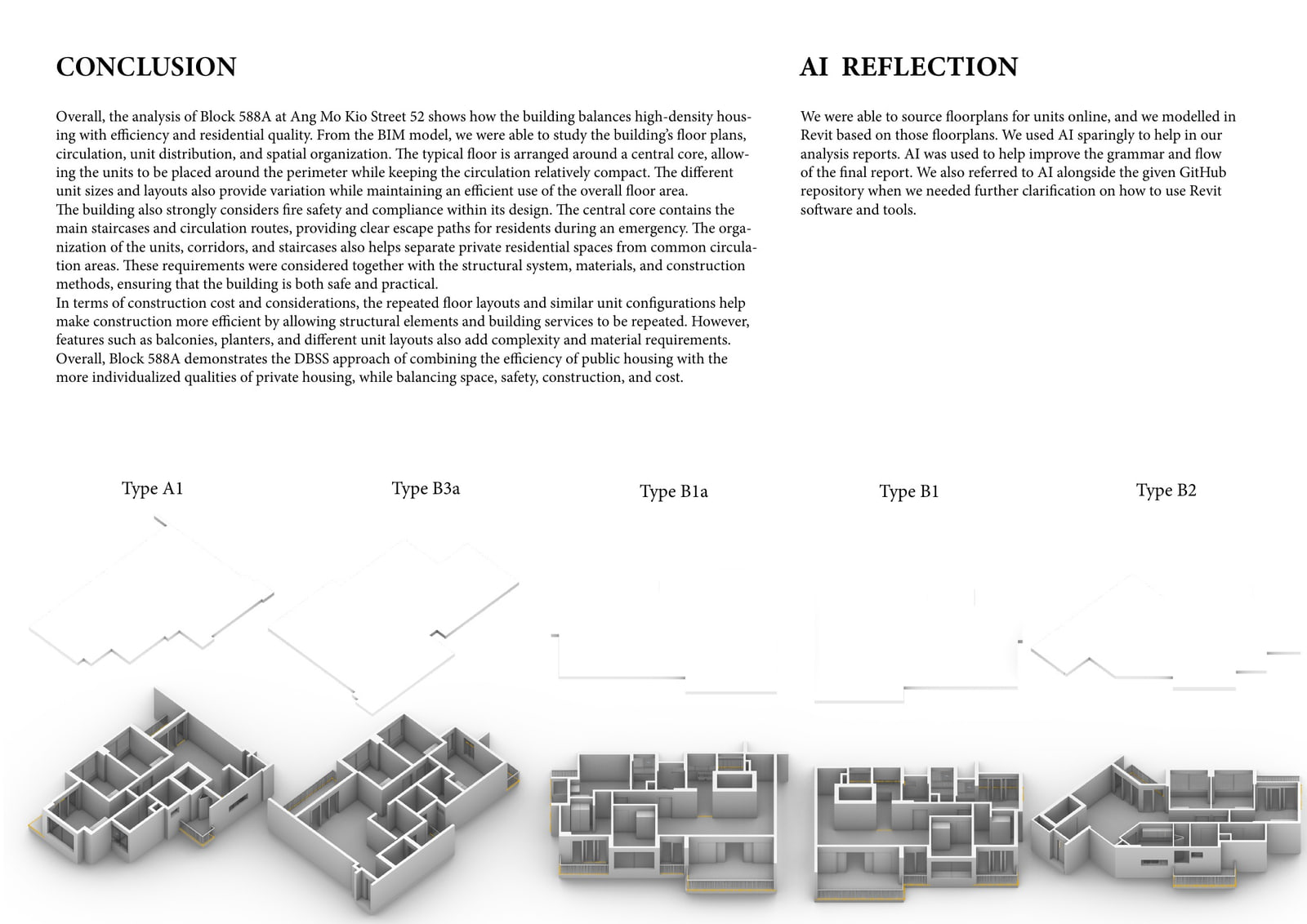
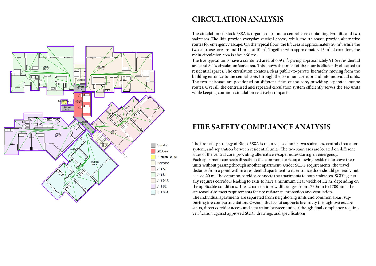
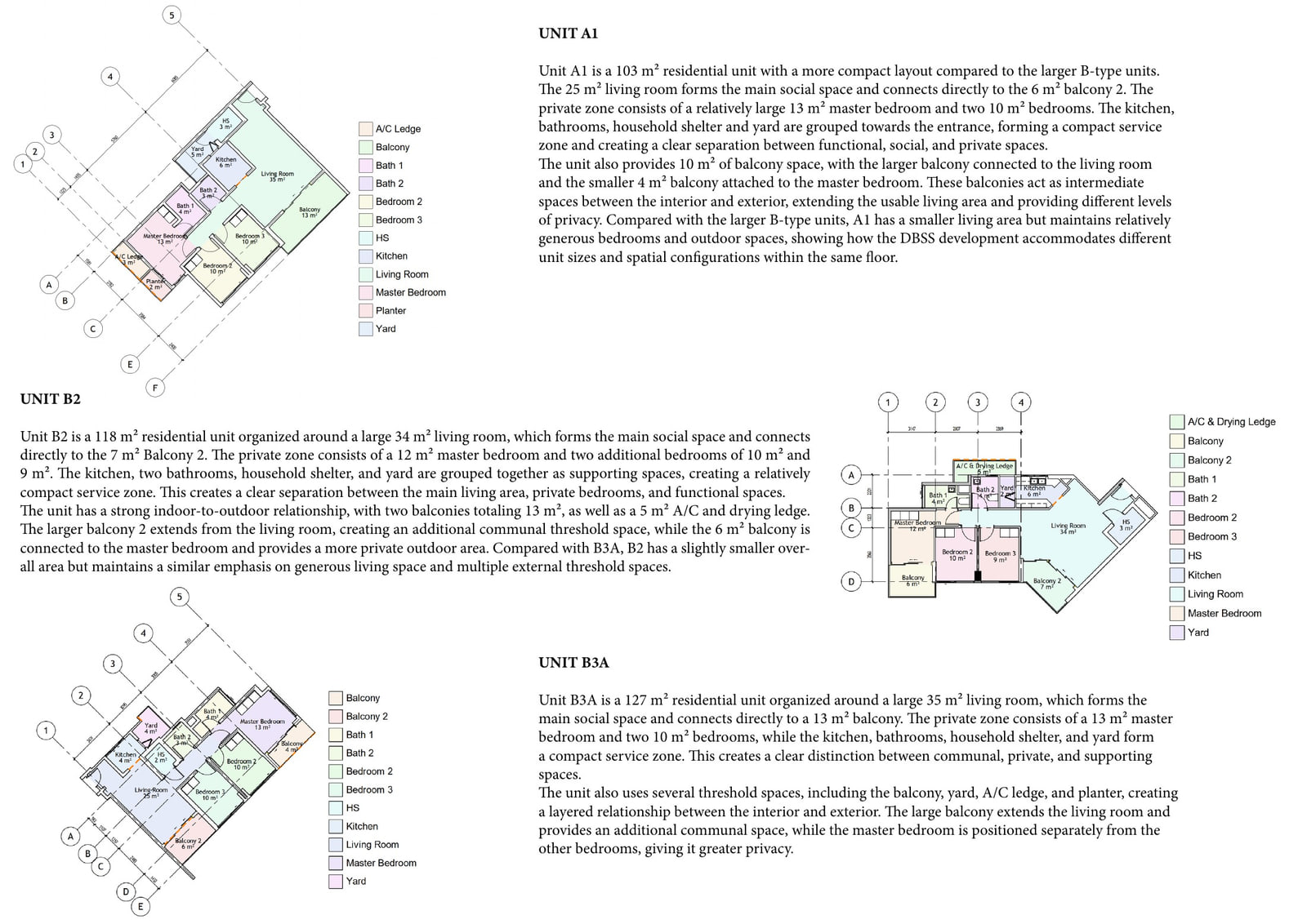
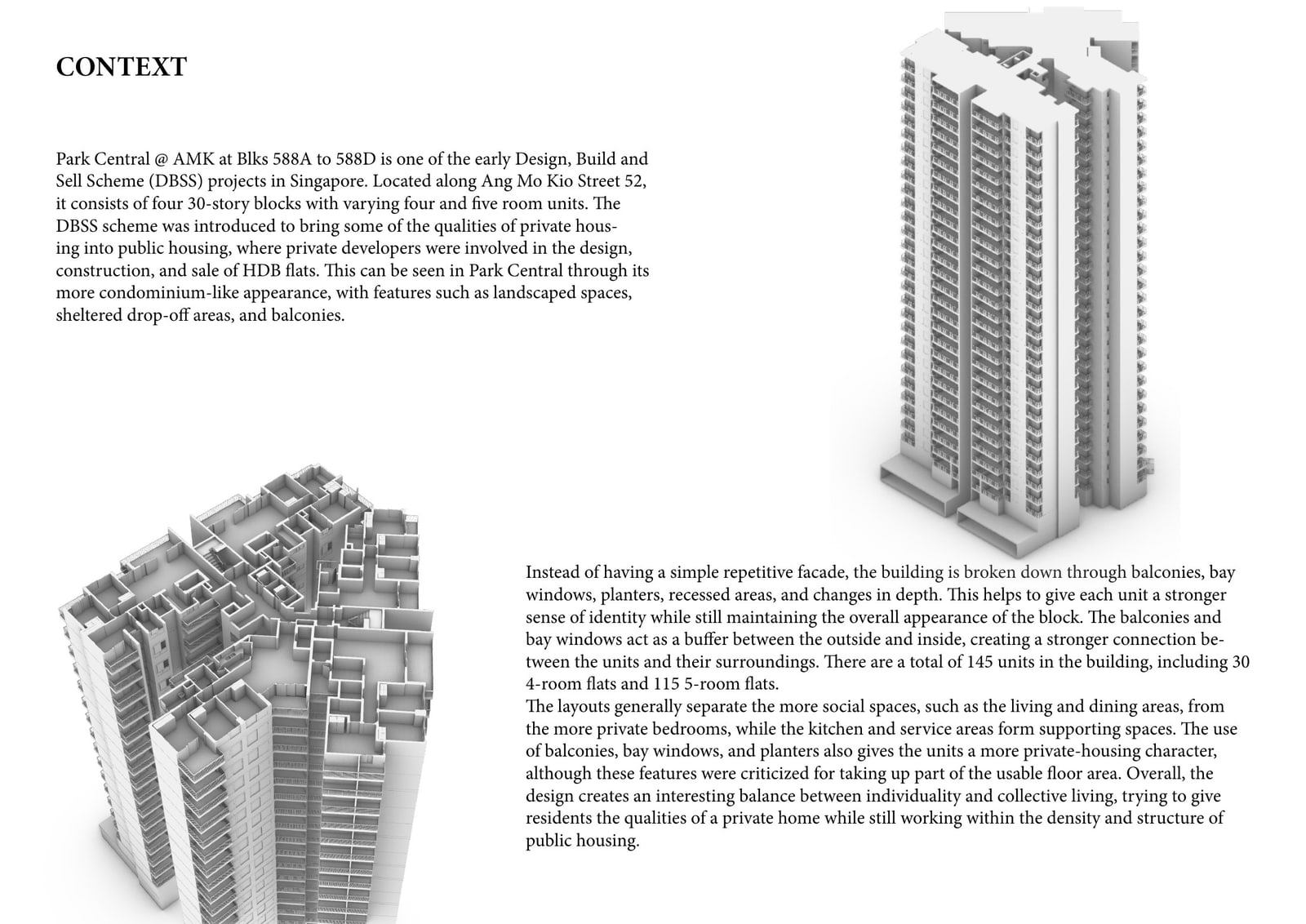
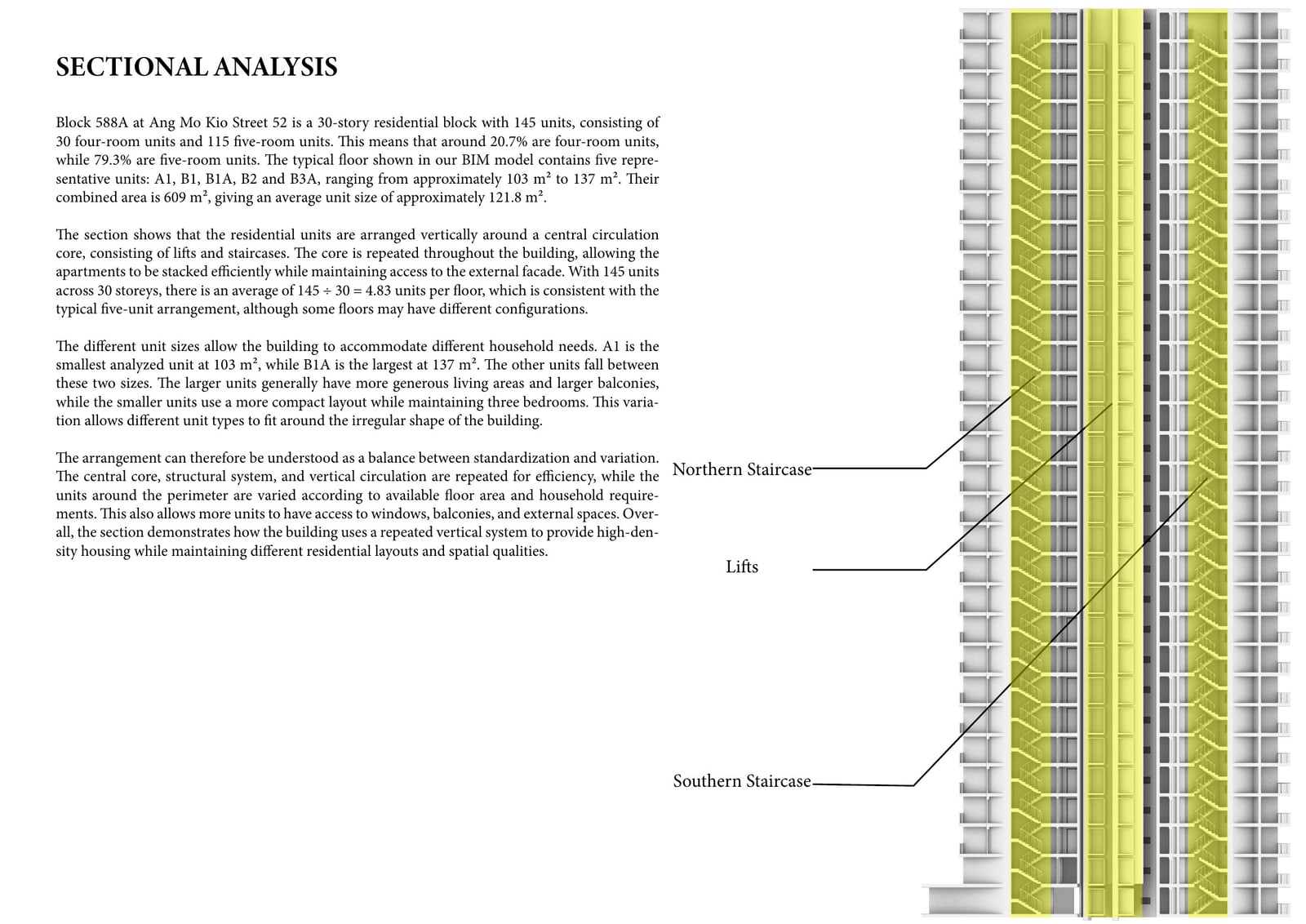
The second assignment takes Block 588A, one of four thirty-storey towers built under the Design, Build and Sell Scheme, containing 145 units split 30 four-room to 115 five-room. Floor plans were sourced and remodelled in Revit, producing massing and cut-away axonometrics, a colour-coded typical floor, a long section through the core, and axonometrics of each of the five unit types. The typical floor carries 609 square metres of residential area against 58 square metres of lift lobby, stairs, corridor and rubbish chute, a residential efficiency of 91.3%. The analysis follows this through into fire safety, checking the two staircases on opposite sides of the core against SCDF travel distance and the 1.2 metre minimum corridor clear width, which the built corridors exceed at 1250 to 1700 millimetres.
The five units, ranging from the 103 square metre A1 to the 137 square metre B1A, are read as variations on a single organisational move: a social zone anchored on the living room and its balcony, a private zone of three bedrooms, and a compact service band of kitchen, bathrooms, household shelter and yard. The report treats the balconies, bay windows and planters that give the DBSS blocks their private-housing appearance as thresholds that also consume usable floor area, and closes by setting the repetition that makes the tower cheap to build against the variation that makes each unit distinct.